


Description
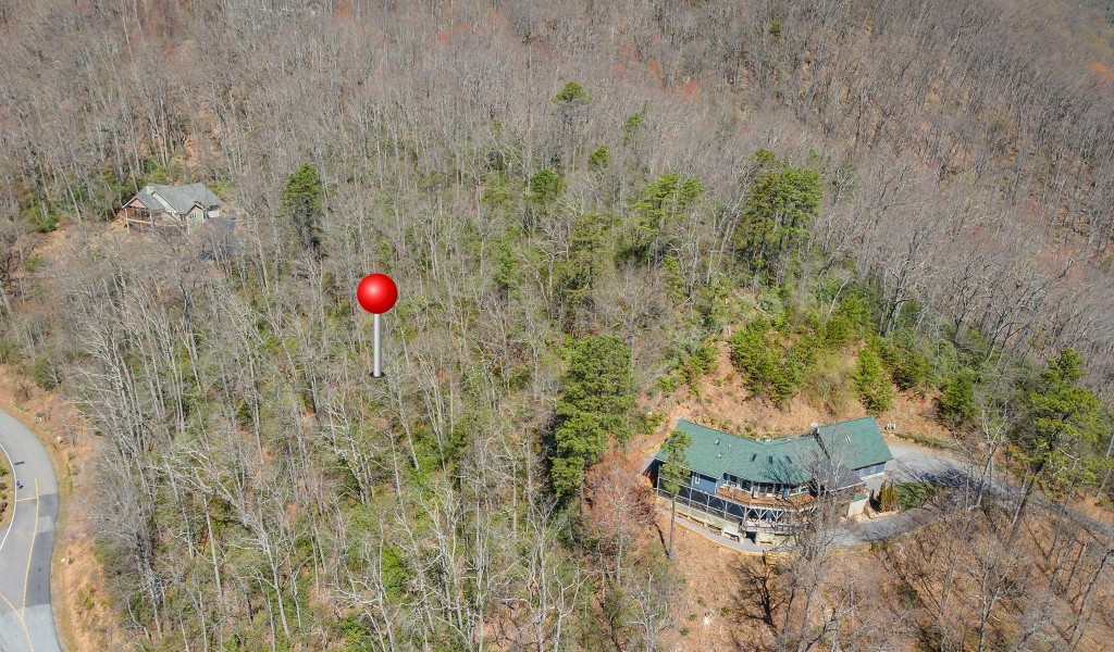
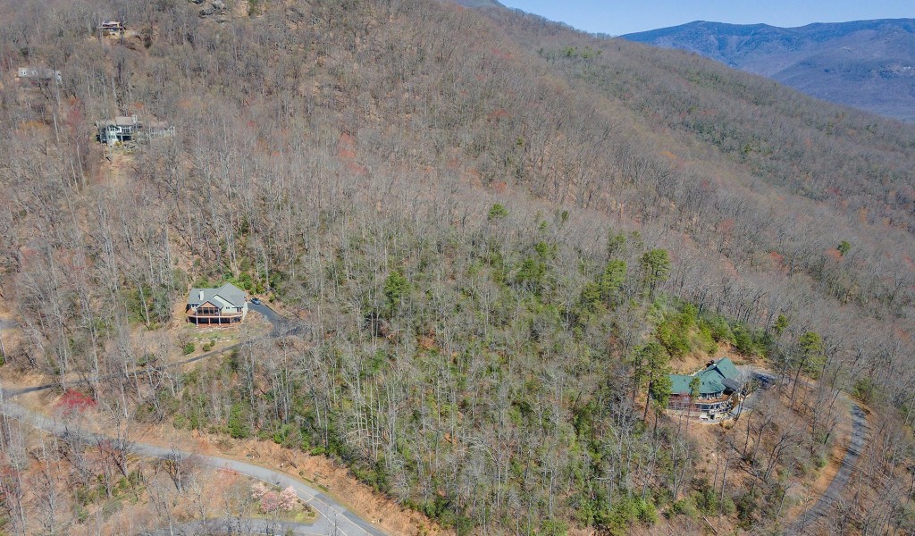
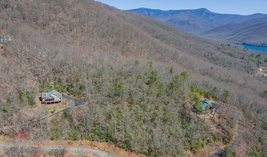
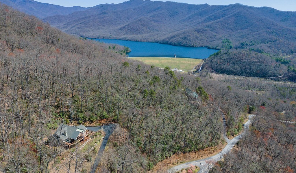
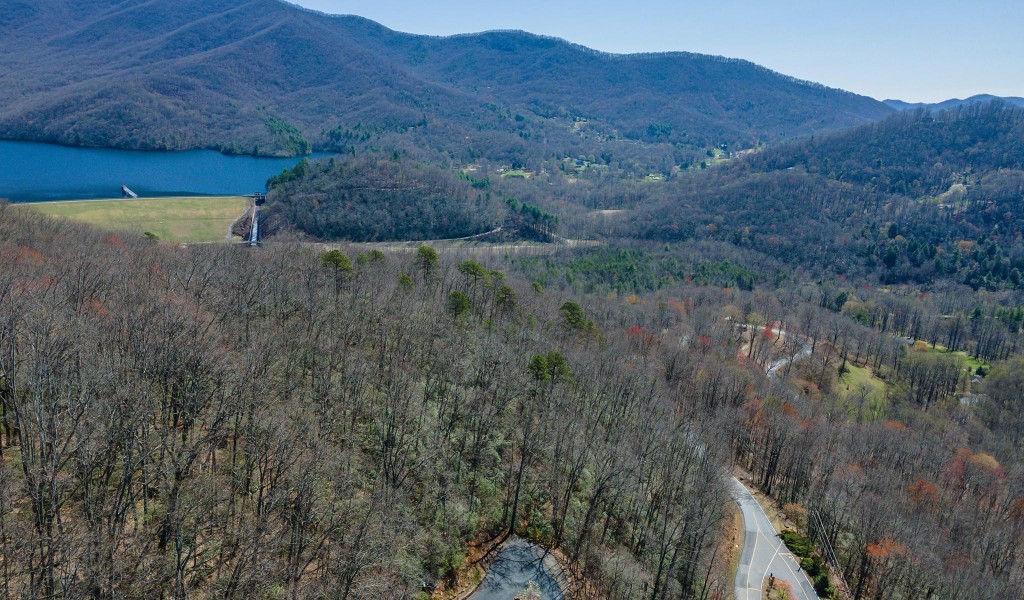
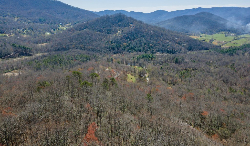
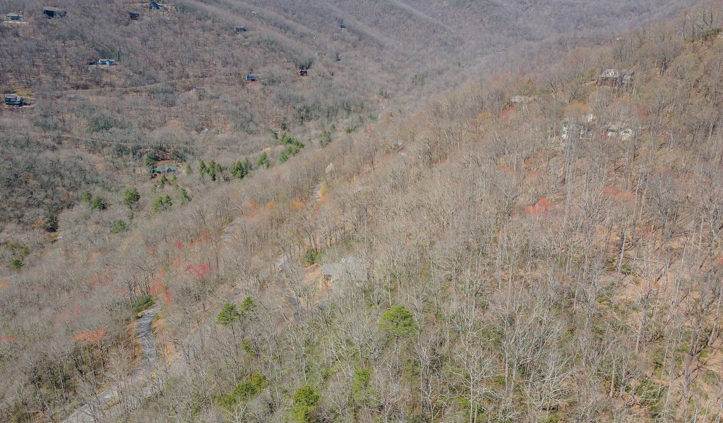
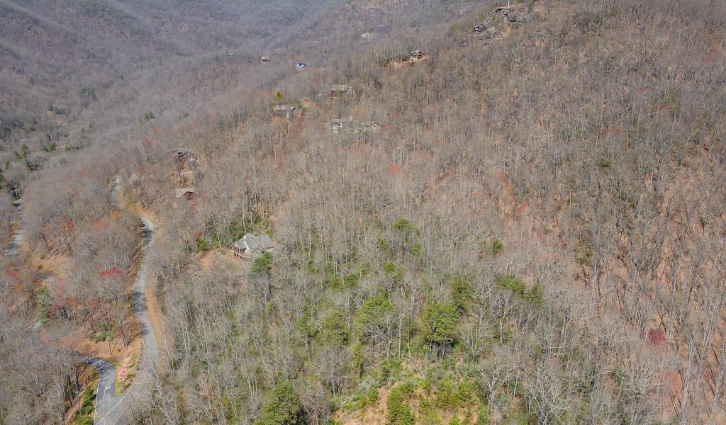
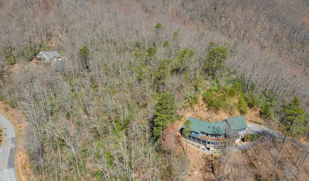
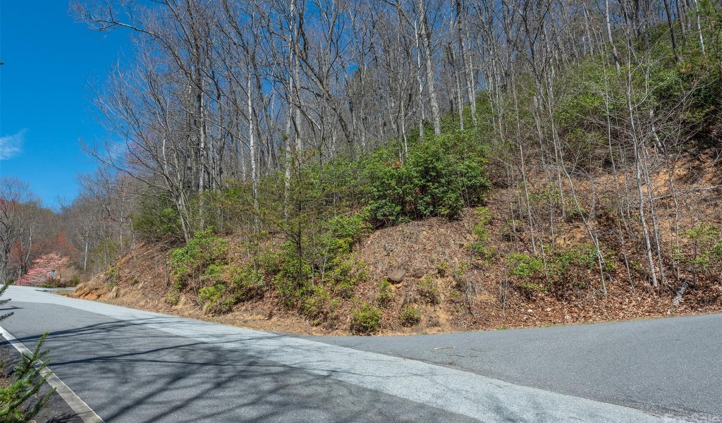
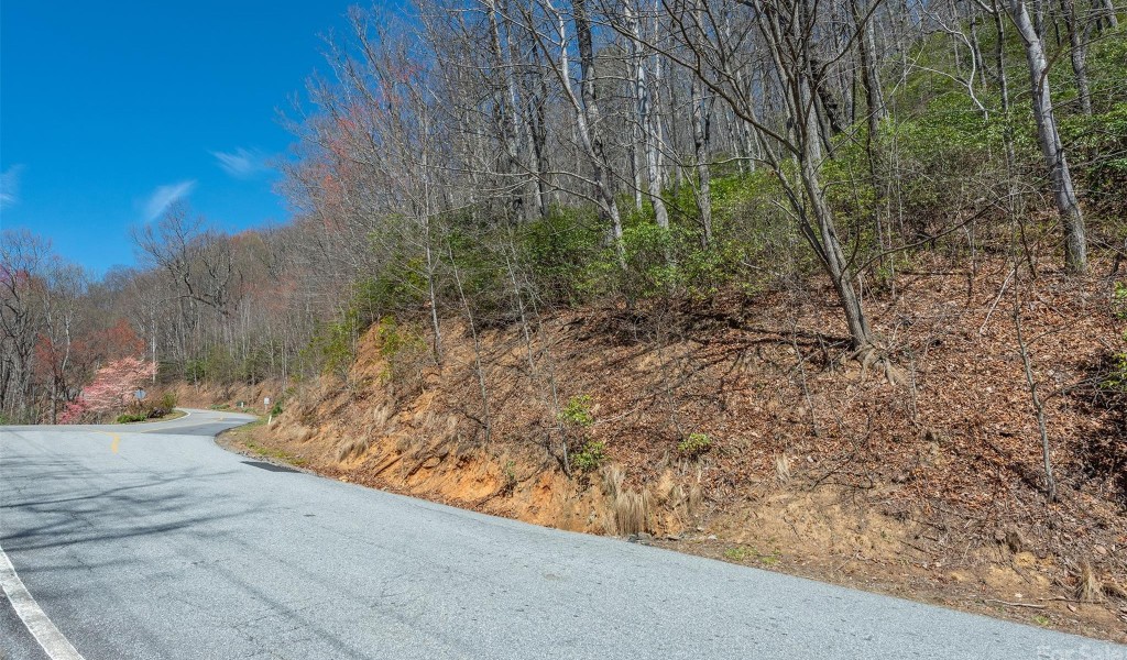
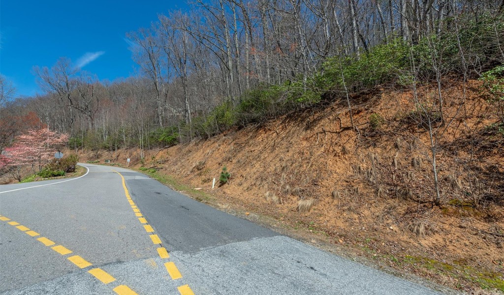
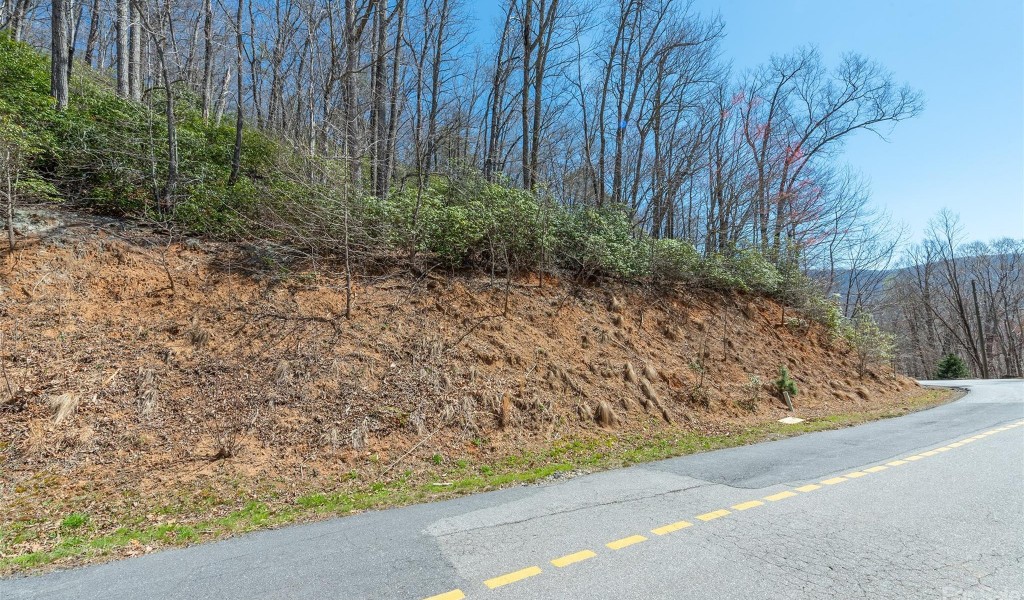
Privacy, layered views, protection by one of black mt's best subdivisions. scenic proximity to b mt/avl downtowns with employment, shopping, recreation, schools, & inc world class arts/crafts, entertainment ctrs. fantastic views of the avl watershed, swannanoa/north fork valleys. ridge top & ridge point views + lays well for a home & pool! typically sloped to sugar maple & winding poplar from ~2,950' elevations but not far inside lr main gate. get out of your car and take trail provided to ridge & see yourself! many lr amenities, hiking/trails, picnic by river (noisy laurel br), lr common areas. this lot borders ~5th largest us "watershed" of 13k acres. privacy-gated entrance-abundant/diverse wildlife-over 92 neighbors-large timbers/rocky environment! lr's fire sub-station/community center above sub-station provides gathering place for private/community/family activities. lr main gate ~10 minutes (4.2mi from gate) from downtown black mountain & ~20-25 minutes from downtown asheville!
Property Type
LandSubdivision
Laurel RidgeCounty
BuncombeStyle
LandAD ID
44191248
Sell a home like this and save $6,995 Find Out How
Statistics Bottom Ads 1

Property Details
-
Interior Features
Heating & Cooling
- WaterSource: City, Other - See Remarks
-
Property / Lot Details
Lot Information
- Lot Description: Paved, Private, Steep Slope, Creek/Stream, Views, Wooded
- Lot Size Area: 2.34 acre
Property Information
- Property Type: Land
- Sub Type: Lot
-
Listing Information
Listing Price Information
- Original List Price: $89900
-
Taxes / Assessments
Tax Information
- Parcel Number: 0701-32-6370-00000
-
Virtual Tour, Parking, Multi-Unit Information & Homeowners Association
Homeowners Association Information
- HOA: 2,400 Annually
-
School, Utilities &Location Details
School Information
- Elementary School: Black Mountain
- Junior High School: Charles D Owen
- Senior High School: Charles D Owen
Utility Information
- Electricity Connected, Fiber Optics, Propane, Solar, Underground Power Lines, Underground Utilities, Wired Internet Available
Location Information
- Subdivision: Laurel Ridge
- City: Black Mountain
- Direction: Take I40E to X64, turn L @RL, go under I-40 & cross RR, thru next 2RL, onto Montreat Rd (Hwy9N). Bear L @next fork onto N Fork Rd & then pass B Mt Golf on left. Bear L at next fork & go to bottom of mt, turn R onto N Fork Rt Fork, follow thru fields & turn L onto Sugar Maple Dr @Laurel Ridge rock. Go to LR gate, use qtrly code if unopened & proceed to next fork with Winding Poplar to right. Pull over and park left of left fork and look for Lot 902 GBR sign on right. Trail head to top of the ridge is found behind GBR sign.
Statistics Bottom Ads 2
Sidebar Ads 1
Learn More about this Property

Sidebar Ads 2
Sidebar Ads 2
Disclaimer: The information being provided by CAROLINA (Canopy MLS) is for the consumer's personal,
non-commercial use and may not be used for any purpose other than to identify
prospective properties consumer may be interested in purchasing. Any information
relating to real estate for sale referenced on this web site comes from the
Internet Data Exchange (IDX) program of the CAROLINA (Canopy MLS). ByOwner.com is not a
Multiple Listing Service (MLS), nor does it offer MLS access. ByOwner.com is a
broker participant of CAROLINA (Canopy MLS). This web site may reference real estate
listing(s) held by a brokerage firm other than the broker and/or agent who owns
this web site.
Properties displayed may be listed or sold by various participants in the MLS
BuyOwner last updated this listing Mon Jun 16 2025
- MLS: CAR4039952
- LISTING PROVIDED COURTESY OF: ,
- SOURCE: CAROLINA (Canopy MLS)
is a Land, with 0 bedrooms which is for sale, it has 0 sqft, 2.34 acre sized lot, and 0 parking. are nearby neighborhoods.